Wintry precipitation coming to Central Ohio this weekend
Published Date: 1/5/2024
Source: WSYX ABC 6
After a frosty Friday morning, we’re enjoying the sunshine this afternoon. But the snow will arrive tonight and we’re likely to see some accumulations by early Saturday morning; most areas get less than an inch before it changes to rain and mix. We’ll have some slick spots on the roads. More mix on Sunday. This will be a sloppy, slushy weekend. Then we’ll get ready for another windy, rainy storm on Tuesday.
FRIDAY NIGHT: snow showers, light accumulations, some slick spots, overcast, low 29.
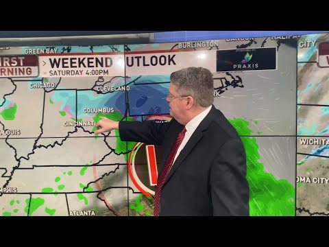
SATURDAY: snow showers in the morning becoming mix and rain in the afternoon, turning slushy, accumulations generally an inch or less, high 38.
SUNDAY: snow showers in the morning becoming wintry mix and rain showers, wet, windy, high 38.
MONDAY: partly to mostly cloudy, melting, high 40.
TUESDAY: overcast, rain, heavy times, gusty winds, gusts as high as 40 mph, high 48.
WEDNESDAY: overcast, rain and snow showers, windy, high 38.
THURSDAY: mostly cloudy, windy, milder, high 42.
FRIDAY: rain and snow showers, windy, high 40.
Advisories are popping up around the country as our next weather-maker continues its journey across the continent. For now, Ohio is enjoying the benefits of some local high pressure and some sunshine. Clouds already are thickening up to the southwest and we’ll see those rolling into the area later this afternoon and evening.
Snow showers arrive in Central Ohio overnight and we’ll get some accumulations before sunrise. Slick spots will be likely, especially on untreated roads and elevated surfaces. For most of the area, accumulations will be less than an inch. The snow showers transition to wintry mix and rain showers in the early afternoon then taper off for the mid-evening. Rain, mix, and snow showers return overnight and for the daylight hours on Sunday. Additional accumulations will be less than an inch again, but slushy roads and driveways will be likely. The precipitation tapers off Sunday evening and high pressure builds into the state on Monday. Sunshine and temperatures near 40°F will help melt off any remaining snow accumulation.
The next system arrives on Tuesday. As it barrels in from the southwest, gusty winds and heavy rain will overspread the region. Gusts could reach 40 mph or more, especially by Tuesday evening and early Wednesday. Rain will be heavy at times on Tuesday. As cooler air wraps around the system on Wednesday, some rain will transition to wintry mix and even some wet snowflakes. At this point, accumulations look unlikely.
Quiet again on Thursday. But another system, on roughly the same path, tracks into Ohio on Friday with another round of gusty winds and rain changing to mix and snow showers. This may be our new pattern for a little while.
_______________
Stay up to date with our social media:
WSYX on Facebook: https://www.facebook.com/WSYXABC6
WSYX on Twitter: https://twitter.com/wsyx6
WSYX on Instagram: https://www.instagram.com/wsyx6/
Subscribe to WSYX on YouTube: https://www.youtube.com/channel/UC6HHWRGuLD11spg9DxKAZlQ//?sub_confirmation=1
Daily News Playlist: https://www.youtube.com/playlist?list=PLVJHjLYVOrAgtGirvHOL3kyw3nSkjE33o
For more information, visit https://abc6onyourside.com/
Have a news tip? Send it directly to us:
Email us: [email protected]
Call the Newsroom: 614.481.6659
WSYX and WTTE are OH based stations owned and operated by Sinclair Broadcast Group. Sinclair Broadcast Group, Inc. is one of the largest and most diversified television broadcasting companies in the country today.
#WSYX #ABC6 #News #WSYX6 #6OnYourSide