Tropical Storm Nicole strikes Bahamas, Florida with surge, heavy rain and high winds
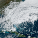
Tropical Storm Nicole is bringing high winds and coastal flooding to eastern Florida while raking the northwest Bahamas with heavy rains and storm surge flooding. It is forecast to become a hurricane before striking Florida overnight.
Threat level: The storm will bring damaging storm surge flooding along the east coast of Florida, north to Georgia and South Carolina, along with heavy rain and damaging winds.
The latest: Shortly before noon, the storm made landfall on Great Abaco Island, and as of 1pm the center of the storm was about 175 miles east of West Palm Beach. It was moving west at 12mph, with maximum sustained winds of 70mph, just shy of hurricane strength.
- Already, coastal flooding, tropical storm force winds and heavy rains are affecting Florida, with flooding also in Georgia and coastal South Carolina. So far, a weather observing station at Lake Worth Pier, Florida, recorded a wind gust to 59 mph.
- If Nicole does hit Florida as a hurricane, it would be the latest in the season that such a storm has hit the state. In fact, even if it is a strong tropical storm, it may rank as one of the top 5 strongest storms to hit the U.S. so late in the season.
- The storm's extraordinary reach, with tropical storm force winds extending 460 miles from the center, ensures that the east and west coasts of Florida will see strong winds from this storm.
- Hurricane, tropical storm and storm surge warnings and watches are in effect from southeastern Florida to South Carolina.
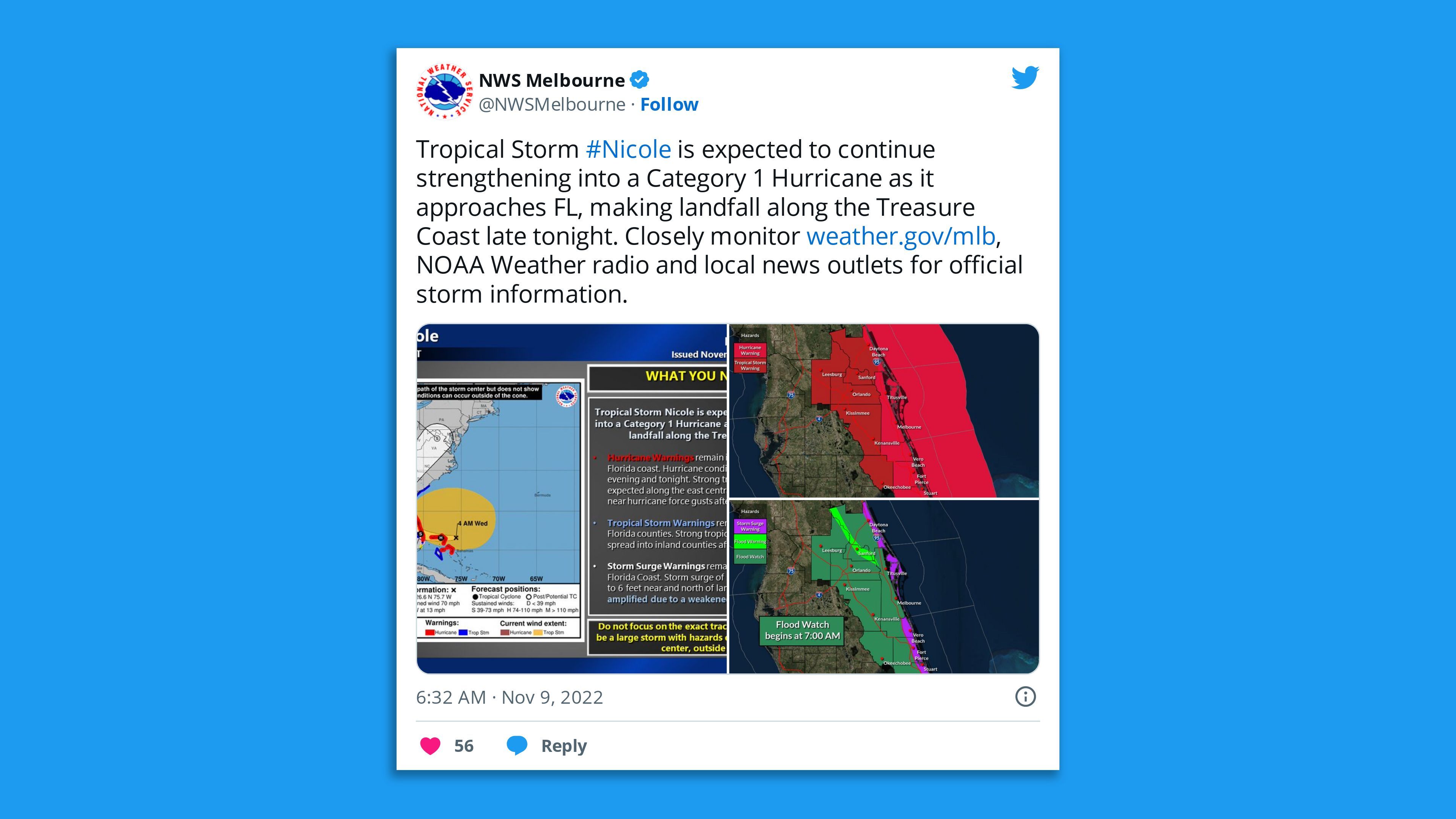
Zoom in: The greatest level of storm surge flooding will be between North Palm Beach, Florida to Altamaha Sound, Georgia, including the St. Johns River. There, surge heights above normally dry ground will range from 3 to 5 feet, NHC forecasts.
- Storm surge flooding is also forecast for the Big Bend area of Florida, a surge-prone region on the state's west coast, since the storm is forecast to emerge over the Gulf of Mexico before turning sharply north-northeast, into Georgia.
- Mandatory and voluntary evacuations are taking place along the eastern Florida coast in preparation for the storm surge.
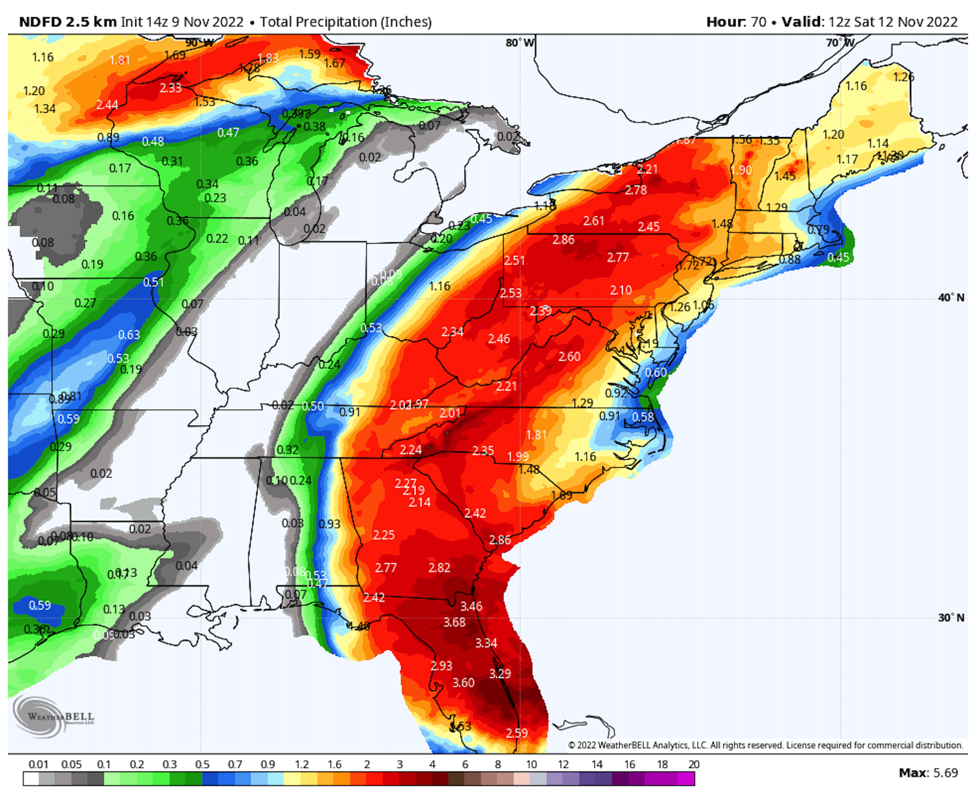
- Heavy rains are also a threat from this storm, with maximum amounts of 8 inches forecast in parts of Florida.
- Parts of the state where the water only recently subsided after Hurricane Ian, such as along the St. Johns River, are likely to see renewed flooding from this storm.
- Heavy rains will spread north as the storm turns up the eastern seaboard, with up to six inches of rain possible in parts of the Appalachians and Blue Ridge Mountains, with soaking rains in the Washington to Boston corridor by this weekend.
Between the lines: NASA is leaving its Artemis I rocket on the launch pad in Cape Canaveral to ride out the storm, but has postponed its Nov. 14 launch attempt to Nov. 16.
- The massive rocket was designed to withstand winds up to 85 mph on the pad, NASA said in a statement. "Current forecasts predict the greatest risks at the pad are high winds that are not expected to exceed the SLS design," the agency said.
- Orlando International Airport plans to close at 4pm ET Wednesday.
- NHC forecasters are cautioning against focusing on Nicole's exact track, stating the storm will bring "Hazards extending well to the north of the center, outside of the forecast cone. These hazards are likely to affect much of the Florida peninsula and portions of the southeast United States."
Editor's note: This story has been updated throughout with the latest forecast information.