Hurricane Ian's climate warning
Hurricane forecasters' worst nightmare came true on Wednesday morning, when what had been a Category 3 storm Tuesday night suddenly jumped almost to Category 5.
Why it matters: It used to be rare for storms to keep strengthening until landfall, let alone do so rapidly. Now it is not — and studies show this is a dangerous sign of climate change.
The big picture: Such an intensity leap was made possible by warm ocean temperatures and abundant atmospheric moisture — both factors that climate change enhances.
- During the past several years, there have been multiple storms that rapidly intensified as they neared the Gulf Coast and did so through landfall.
- Previously, tropical storms and hurricanes tended to weaken as they neared the northern Gulf Coast in particular, falling victim to cooler waters or stronger jet stream winds.
- But that did not happen with Hurricanes Laura or Ida in 2020 and 2021 — or with Hurricane Michael, which ramped all the way up to a Category 5 storm in the Florida Panhandle in 2018.
It's not just the U.S. that has been suffering the consequences from rapidly intensifying tropical cyclones. Consider an example from halfway around the world, which occurred just as Ian was spinning up in the Caribbean.
- At the same time in the western tropical Pacific Ocean, a storm named Noru began swirling toward the Philippines.
- It took forecasters by surprise when it suddenly strengthened from a robust tropical storm, with maximum sustained winds of 60 mph, to a Category 5 super typhoon with 160 mph winds in just 24 hours.
- This was one of the fastest rates of intensification on record, anywhere, and it gave residents of the heavily populated island of Luzon little to no time to prepare.
Threat level: The danger of a rapid intensification shortly before landfall is that people will be caught off guard by the stronger storm, and get stuck in a vulnerable spot for storm surge flooding, damaging winds or both.
- Emergency management officials design their evacuation plans based on storm intensity and movement. Sudden shifts in either one can render their planning inadequate.
- A 155-mph Category 4 storm, which Hurricane Ian became on Wednesday morning, can push a far higher surge inland and bring a catastrophic swath of high winds inland, compared to the 120-mph Category 3 storm that Ian was when most Floridians went to sleep Tuesday night.
- All landfalling storms now contain more dangerous coastal flooding in their arsenals, due to human-caused sea level rise.
Between the lines: The trends seen in the past several years, together with studies of how hurricanes are changing in a warming world, point to a key role for human-caused climate change.
- Warm, tropical waters are the main source of fuel for hurricanes, and the oceans are absorbing about 93% of the extra heat going into the climate system from human-caused emissions of greenhouse gases.
- Air temperatures are also increasing, and when that happens, the air can hold more water vapor. This is helping to make hurricanes wetter than they used to be.
- A 2020 study published in the Proceedings of the National Academy of Sciences found that tropical cyclones are now more likely to reach higher categories across much of the globe, including the Atlantic.
- In addition, a 2019 paper in the journal Nature Communications found a trend in Atlantic hurricanes toward more rapid intensifiers during the 1982-2009 period. Computer modeling showed this was unlikely due to natural climate fluctuations alone.
Yes, but: While forecasters have made great strides in predicting storm tracks several days in advance (though the Ian track forecast was more uncertain than most), intensity forecasts have been stuck.
- With Ian, while forecasters predicted it would intensify rapidly, the trend started later than they anticipated — and then continued through landfall, which they didn't expect. Some forecasts had said the storm would weaken before landfall.
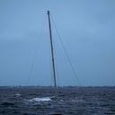
The bottom line: There is research underway to better predict intensity shifts, using new technologies such as Saildrones, satellites and other sensors.
- But until we crack the code of how to tell that a storm will leap through categories just before landfall, with enough lead time to act, we are going to be vulnerable to more devastating, and potentially deadly, surprises.