Tropical Storm Ian: See latest forecast cone, spaghetti models, satellite
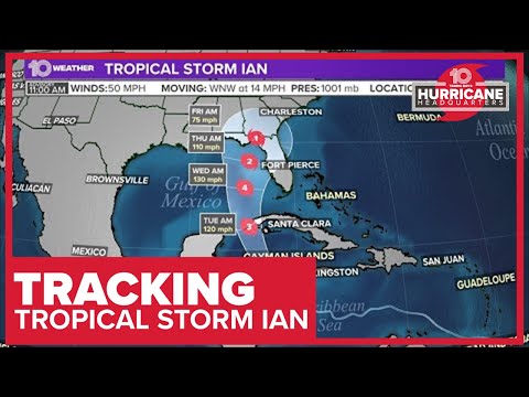
Tropical Storm Ian remains forecast to rapidly intensify and become a hurricane sometime Monday, according to the National Hurricane Center. Forecasters warn that Florida — especially the western Gulf coast, including Tampa Bay up to the Panhandle — should continue to monitor Ian's progress.
As of the 5 p.m. Sunday advisory, Tropical Storm Ian was located about 220 miles south-southeast of Grand Cayman, with sustained winds of 45 mph. Ian's movement is west-northwest at 12 mph.
The NOAA hurricane hunters surveillance jet earlier this morning found Tropical Storm Ian continuing to organize over the central Caribbean.
MORE: https://bit.ly/3dBbnys
►Subscribe: https://on.wtsp.com/youtube
►Website: https://www.wtsp.com/
►Facebook: https://facebook.com/10TampaBay
►Twitter: https://twitter.com/10TampaBay