Strengthening Hurricane Ian threatens Cuba and Florida
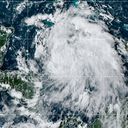
The eyewall Hurricane Ian was nearing Cuba early Tuesday as Florida was lashed with the outer bands of the Category 2 storm — which the National Hurricane Center warns could rapidly intensify into a Category 4 by midweek.
State of play: Ian was packing maximum sustained winds of 110 mph some 85 miles east of the western tip of Cuba at 2am Tuesday — just 1 mph off being classified as a major hurricane. There's a "danger of life-threatening storm surge" along much of the Florida west coast," the NHC said.
9/26 9:45PM - Heavy rain in association with an outer rain band of #Ian is beginning to spread across east coast metro areas this evening. Torrential rainfall, gusty winds and urban flooding are primary hazards. Driving conditions will quickly become extremely hazardous! #flwx pic.twitter.com/4SGE8oB0KX
— NWS Miami (@NWSMiami) September 27, 2022
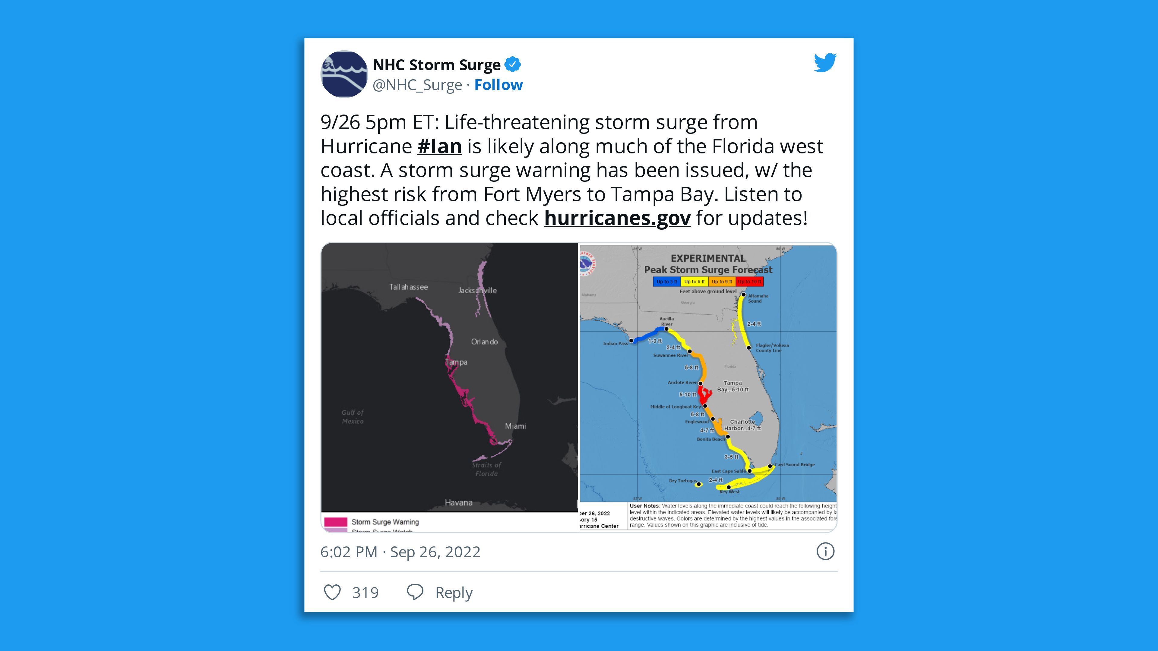
Details: Hurricane warnings were in effect for several Cuban provinces, as well as Florida regions from Englewood to the Anclote River, including the flood-prone Tampa Bay, and the Dry Tortugas.
- A tropical storm warning was issued for the lower Florida Keys, from Seven Mile Bridge westward to Key West, as well as several provinces in Cuba.
- "Hurricane-force winds are expected in the hurricane warning area in west-central Florida beginning Wednesday morning with tropical storm conditions expected by late Tuesday," the NHC said.
- Communities along Florida's west coast from Fort Myers to the Tampa Bay region were most at risk from storm surges, the agency noted.
The big picture: President Biden declared a federal state of emergency for multiple Florida counties on Saturday night, and Florida Gov. Ron DeSantis has declared a state of emergency for the entire state.
- Evacuation orders were issued across Florida and Cuba on Monday.
What to watch: Ian was expected to become a major hurricane — Category 3 or higher — near Cuba early Tuesday and remain as such over the southeastern Gulf of Mexico on Wednesday.
- The NHC said it's concerned about the "slower forward motion that is forecast during this period, as the upper trough passes north and east of Ian and the steering currents weaken," which will "likely prolong the storm surge, wind, and rainfall impacts along the affected portions of the west coast of Florida."
By the numbers: "Storm surge could raise water levels by as much as 9 to 14 feet above normal tide levels along the coast of western Cuba in areas of onshore winds in the hurricane warning area early today," the agency said.
- The National Hurricane Center forecast four to six inches of rainfall from the Florida Keys, Coastal Southwest and Southeast Florida from Monday through Thursday.
- Central West Florida could see six to 12 inches of rainfall and six to 10 inches could fall in the state's northeast, according to the NHC.
Threat level: Studies show an increase in the occurrence of rapid intensification due to human-caused climate change.
- The western Caribbean Sea is a powder keg for hurricanes right now, with high ocean heat content and weak upper-level winds.
What's next: The key questions facing forecasters, public officials and tens of millions of residents along the Gulf Coast are where the storm will head once it becomes a hurricane, and how strong it will be once it gets there.
- The computer models have been diverging, with some showing a landfall in northwestern Florida or perhaps southeastern Alabama. Others show a hit much farther east, closer to Tampa.
- Forecast trends since Friday have nudged the most likely track of the center of Ian to the west, closer to the Panhandle region of Florida.
- While the likelihood of significant impacts in South Florida has decreased, it has not entirely disappeared, and the Hurricane Center is urging all Floridians to prepare for storm impacts.
Context: Human-caused climate change is altering the characteristics of nature's most powerful storms.
- For example, sea level rise from melting ice sheets makes a hurricane's storm surge more harmful.
Editor's note: This story has been updated with the storm's strengthening, the latest estimates and details of evacuations.