Pakistan floods: Before and after satellite photos show the enormity of the devastation
Published Date: 8/29/2022
Source: axios.com
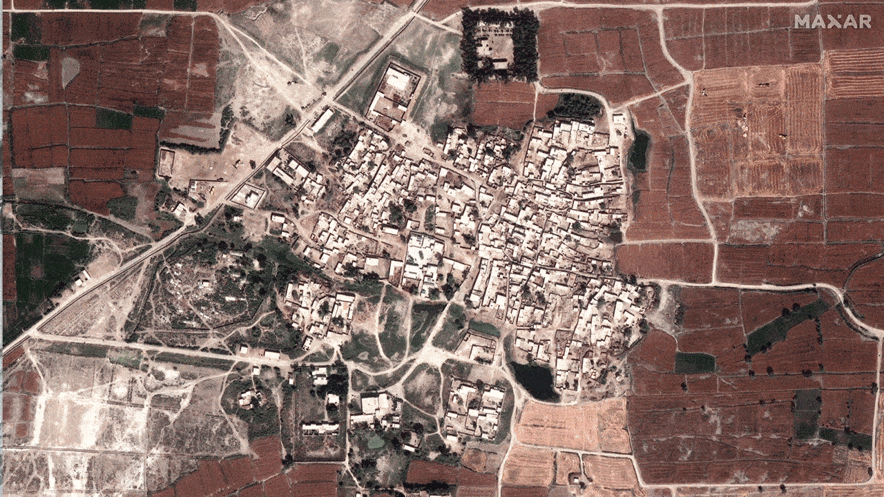
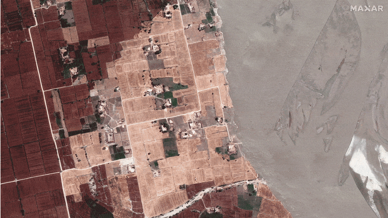
Village and fields before and after flooding in Rajanpur, Pakistan as of August 28, 2022. Photo: Maxar
The scope and severity of the flooding in Pakistan from two months of unusually heavy monsoon rains is drawing comparisons to the devastating rains of 2010. In some respects, it may exceed that benchmark.
The big picture: The flooding is especially severe in Sindh and Balochistan provinces in the country's south, where the Indus River has swelled well beyond its banks.
- International aid groups are mobilizing to provide support to millions displaced by the floodwaters, and the Pakistani military has been called into action. More than 1,000 people have been killed, according to officials.
- Pakistani officials have tied the flooding to human-caused climate change. Studies show that extreme precipitation events are becoming more intense and longer-lasting as global temperatures increase.
Zoom out: Satellite images capture the enormity of the challenge facing Pakistan — home to about 220 million people — in responding to this disaster.
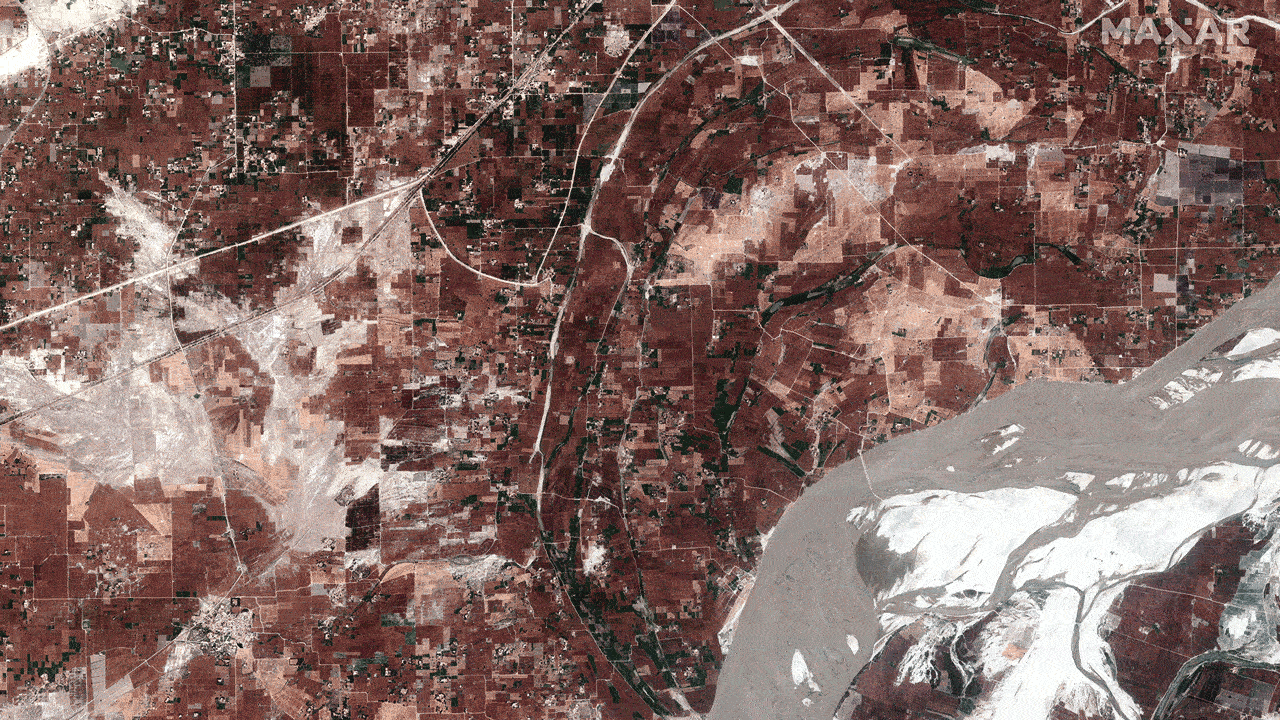
Overview of the Indus River before and after flooding in Rajanpur, Pakistan as of Aug. 28. Photo: Maxar
Close up view of homes and fields before and during flooding in Rajanpur, Pakistan as of Aug. 28. Photo: Maxar
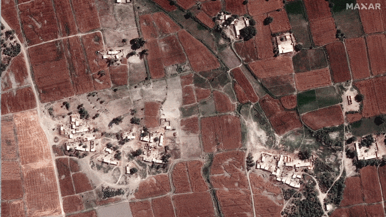
Fields and homes along the Indus River before and flooding in Rojhan, Pakistan as of Aug. 28. Photo: Maxar