Heat wave to set more records from Midwest to the South this week

Extreme heat currently roasting the Upper Midwest and northern Plains is forecast to shift south and southeastward during the week. Temperature records will be in jeopardy in cities such as Atlanta, Nashville, Memphis, Little Rock, and St. Louis during mid-to-late week.
Why it matters: Heat waves are an acute public health threat, since heat ranks as the top weather-related killer in the U.S. on average each year.
- For the past two weeks, extreme heat has broken records from the Southwest to the Plains and Midwest, contributing to wildfires and severe thunderstorms that knocked out power to hundreds of thousands across the Midwest.
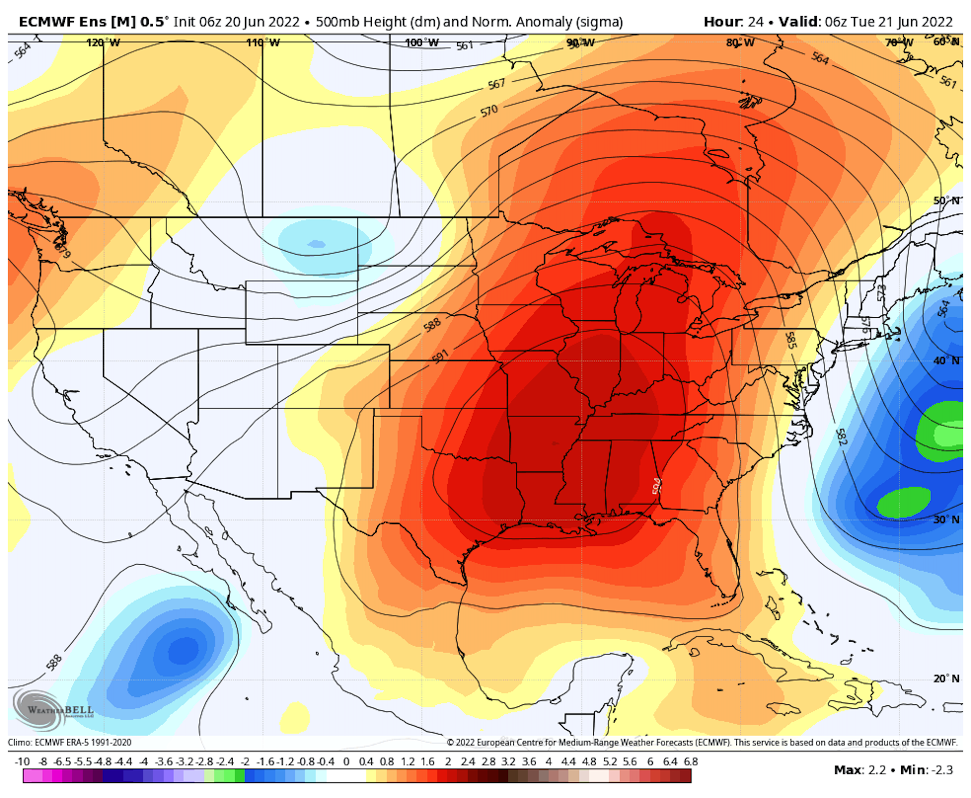
- The area of high pressure, or heat dome, responsible for the hot weather continues to roam the country, and shows few signs of dissipating for good amid a large northward bulge, or ridge, in the jet stream.
- The National Weather Service (NWS) is calling the high temperatures "excessive" and "well above average" for this time of year.
The big picture: On Monday, heat advisories and excessive heat warnings are in effect for another day in all of Minnesota and portions of six other states, where heat indices are climbing into the triple digits.
- The forecast high temperature on Monday in Grand Forks, N.D. is forecast to reach 95°F, well above the average high for this time of year, which is 79°F. The city set a record high on Sunday.
- An excessive heat warning is also in effect for Minneapolis-St. Paul, where Monday's forecast high is 100°F. This would beat the existing daily record of 99°F set in 1933.
What's next: The head dome is going to slide southward and set up shop over the Tennessee Valley by midweek, bringing a broad area of clear skies and stagnant air to the South and Southeast.
- Chicago, Detroit and St. Louis will see hot temperatures yet again as the heat dome shift begins, with the hottest weather lasting from Tuesday to Wednesday.
- By mid-to-late week, air temperatures combined with high humidity will send heat indices climbing to dangerous levels, between 105 and 110°F, in states such as Tennessee, Alabama, Mississippi, Georgia, Louisiana and Arkansas, among other locations.
- The NWS said Monday that heat advisories and warnings will be needed across many of these areas.
- For example, Atlanta is forecast to reach 100°F for a high on Wednesday and Thursday, which would break daily records.
- Later this week, triple-digit heat, which will break records in some locations, looks to redevelop in much of Texas, too. Next weekend could feature a heat wave primarily located across the Gulf Coast.
Context: Heat waves such as this one are becoming hotter, more frequent and longer-lasting due to human-caused climate change, according to numerous scientific studies. As the global average surface temperatures increase, the probability of warm extremes, often referred to as "long tail" events, skyrockets.
- The heat has further skewed the balance of temperature records set across the U.S., which has already been tilted strongly in favor of warm extremes over time.
- During the seven days ending on June 17, 2,074 warm temperature records had been set or tied in the Lower 48 states, compared to just 444 cold temperature records during the same period, according to a NOAA database.
- During the same period, 22 all-time warm temperature records, either daily highs or warm overnight temperatures, were set or tied, whereas no all-time cool temperature records were set or tied.
- As the U.S. heat has been taking place, an even fiercer heat wave has been hitting Europe, setting dozens of monthly high-temperature records and several all-time high-temperature records as well.